![]()
Total length 49Km (30.4 miles). Mikunibashi Bridge (Kitakawabe, Saitama
Pref.) from Kin-obashi Bridge (Kiryu, Gunma Pref.)
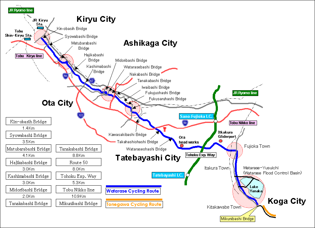
Detail Map
Detailed map around Kin-obashi Bridge Detailed map around Matubarabashi Bridge
Detailed map around Fujioaohashi Bridge Watarase-Yusuichi (Watarase Flood Control Basin)
Under construction
桐生 崇禅寺
The translation cooperation is Mr. Watanabe & Ms. JUN.